
NASA has been at the forefront of space exploration for decades, but their latest endeavor has taken them back to Earth to help in a different way. Recently, the space agency tested its new Compact Fire Infrared Radiance Spectral Tracker (c-FIRST) over California wildfires, marking a significant step towards improving real-time fire tracking.
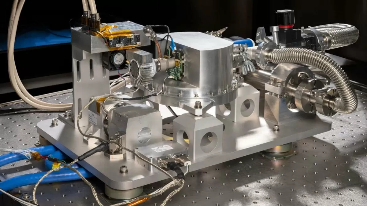
Managed by NASA’s Jet Propulsion Laboratory (JPL), the c-FIRST instrument is a cutting-edge technology designed to capture high-resolution thermal infrared data. With this data, experts are able to identify temperature variations across wildfire-affected areas, providing critical information to firefighting agencies and aiding in their efforts to contain and extinguish the fires.
Wildfires are a major concern, especially in areas like California where they are a frequent occurrence. According to the California Department of Forestry and Fire Protection, there were over 9,900 wildfires in 2020, burning over 4.2 million acres of land. These devastating fires not only cause destruction to wildlife and vegetation, but they also pose a serious threat to human lives and property.
That’s where c-FIRST comes in. By providing real-time data on the spread and intensity of wildfires, this technology has the potential to significantly improve the effectiveness of firefighting efforts. This is particularly crucial in the early stages of a fire, as it allows agencies to quickly identify the most vulnerable areas and prioritize their resources accordingly.
The c-FIRST instrument was mounted on NASA’s ER-2 aircraft and flown over the California wildfires in September 2021. This aircraft, known as the “flying laboratory,” is a modified version of the U-2 spy plane and has the capability to fly at high altitudes, providing a unique perspective for data collection.
During the flight, the c-FIRST instrument captured thermal infrared images of the wildfires, which were then analyzed by scientists at JPL. These images showed the temperature variations across the fire-affected areas, with different colors representing different levels of heat. By mapping these temperature differences, experts were able to create detailed wildfire maps, providing crucial information to firefighting agencies on the ground.
This technology has the potential to revolutionize the way we track and fight wildfires. Traditionally, firefighting agencies have relied on satellite images and ground observations, which can be limited and time-consuming. With c-FIRST, they can now access real-time data, allowing them to make more informed decisions and respond more quickly to changing conditions.
Not only does this technology have potential applications for firefighting agencies, but it can also be used for other purposes, such as monitoring volcanic eruptions, droughts, and other natural disasters. The high-resolution images captured by c-FIRST can provide valuable information on the extent and severity of these events, aiding in disaster response and management.
In addition to its real-time capabilities, c-FIRST has the advantage of being able to operate in smoky conditions. Traditional satellites and other instruments have difficulty capturing clear images in these conditions, making it challenging to monitor wildfires. However, the thermal infrared technology used by c-FIRST allows it to penetrate through the smoke, providing accurate and detailed images.
The success of the c-FIRST test flight over California wildfires has paved the way for future use of this technology in firefighting efforts. NASA plans to continue testing and refining the instrument, with the ultimate goal of integrating it into firefighting operations in the future. This could potentially save lives and minimize the damage caused by wildfires, making it a game-changer in the fight against these devastating events.
In conclusion, NASA’s c-FIRST instrument has demonstrated its potential to revolutionize real-time fire tracking and aid in firefighting efforts. Managed by JPL, this cutting-edge technology has the capability to provide high-resolution thermal infrared data, giving experts a unique and valuable perspective on the spread and intensity of wildfires. With continued development, c-FIRST has the potential to be a crucial tool in mitigating the devastating effects of wildfires and other natural disasters.


